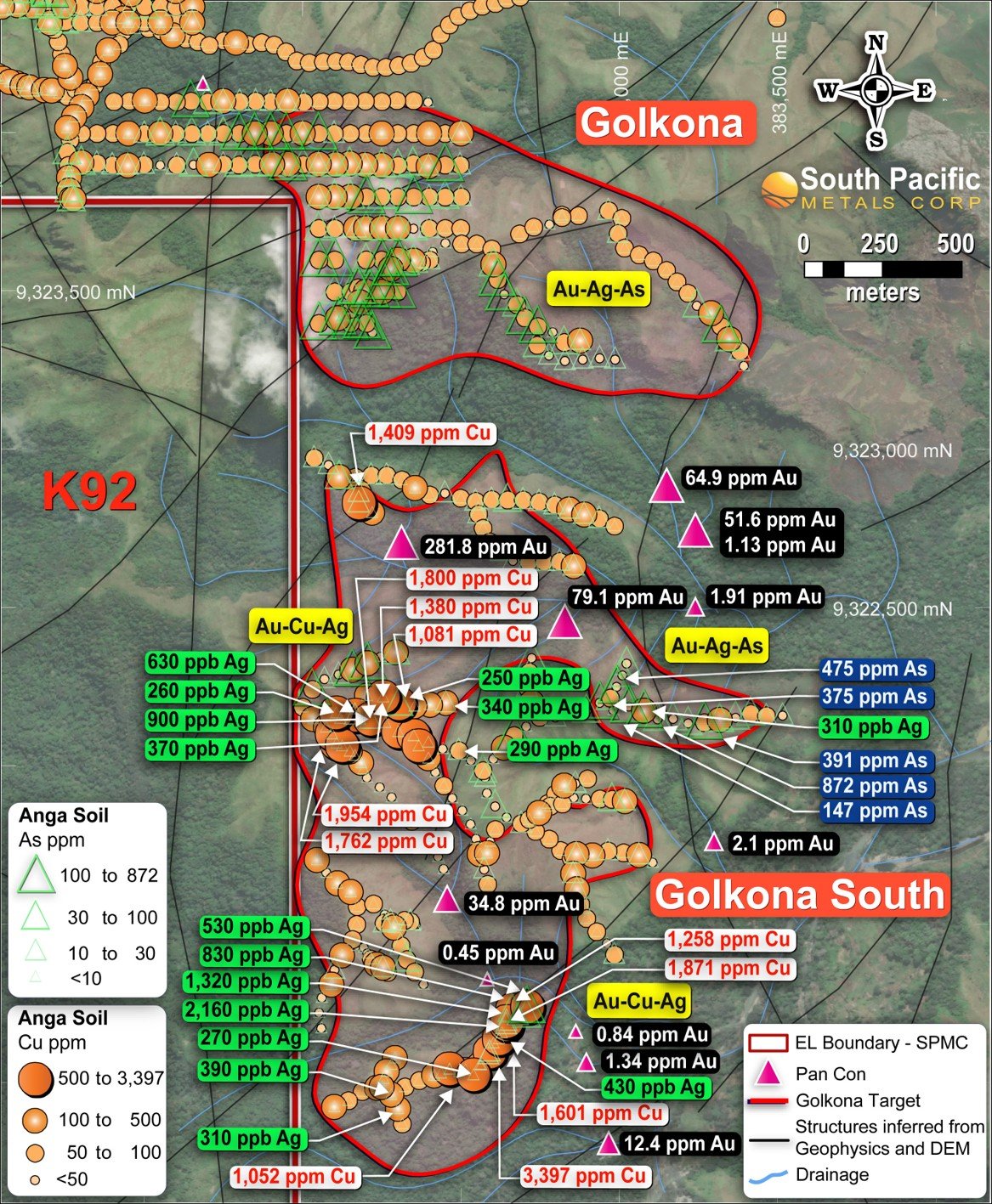
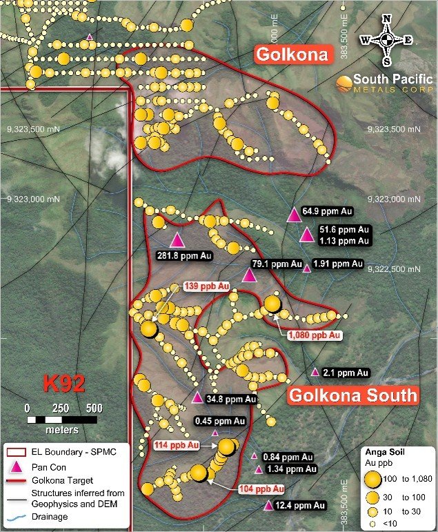
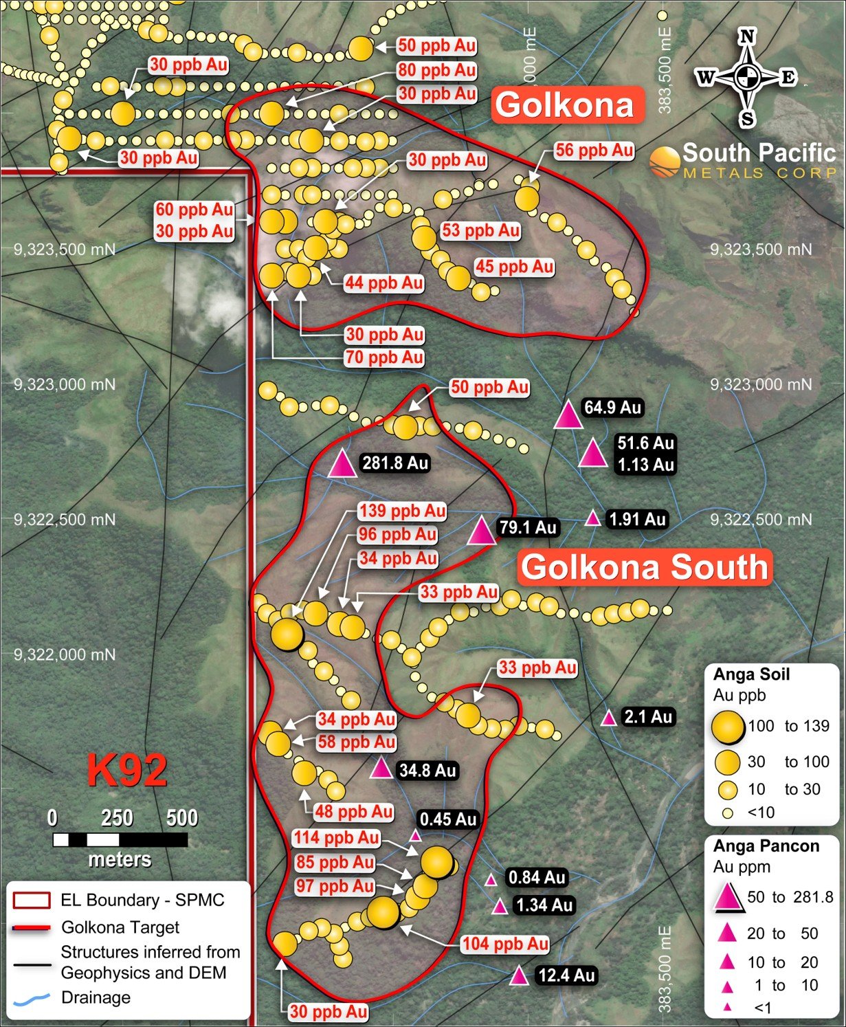
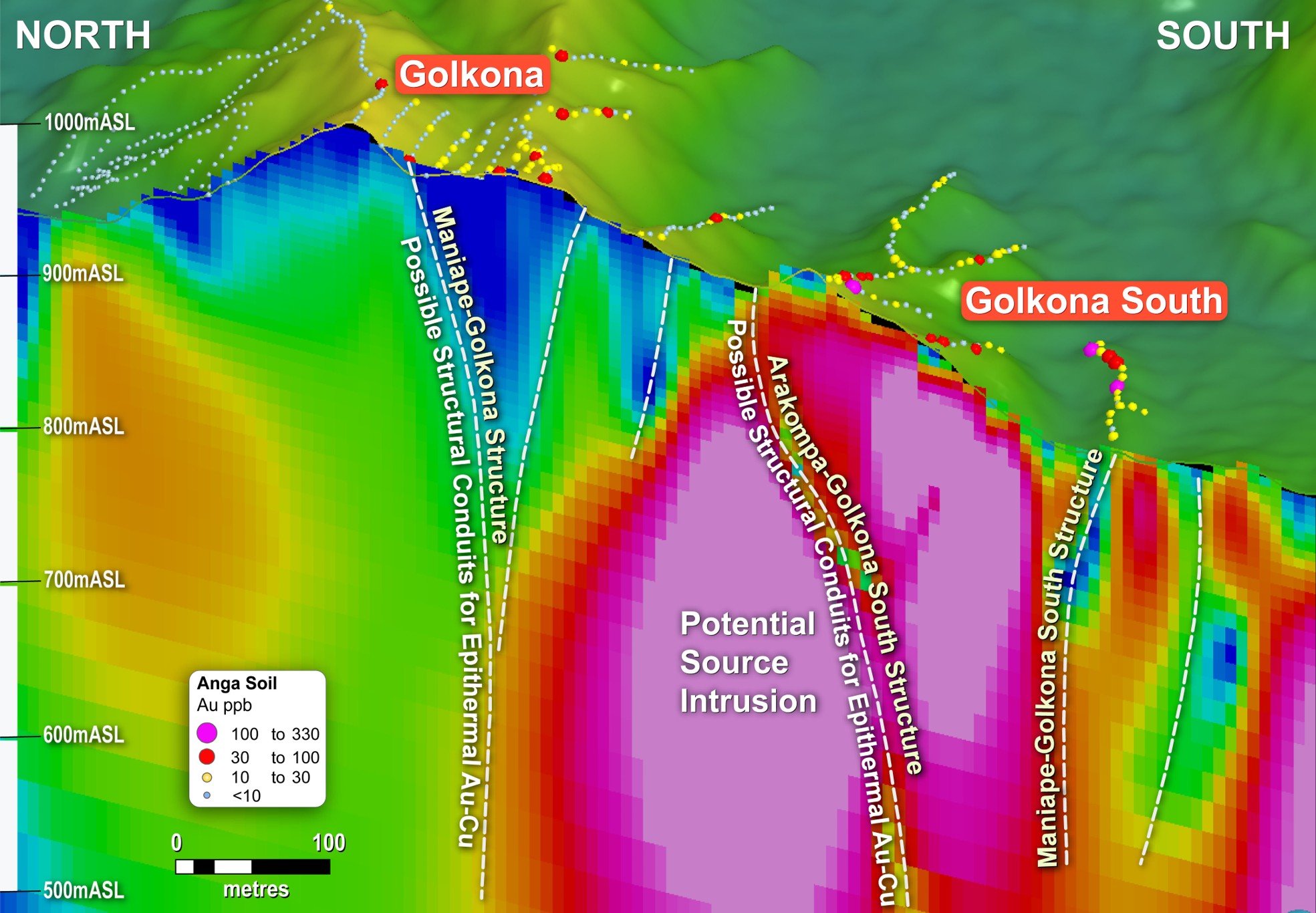
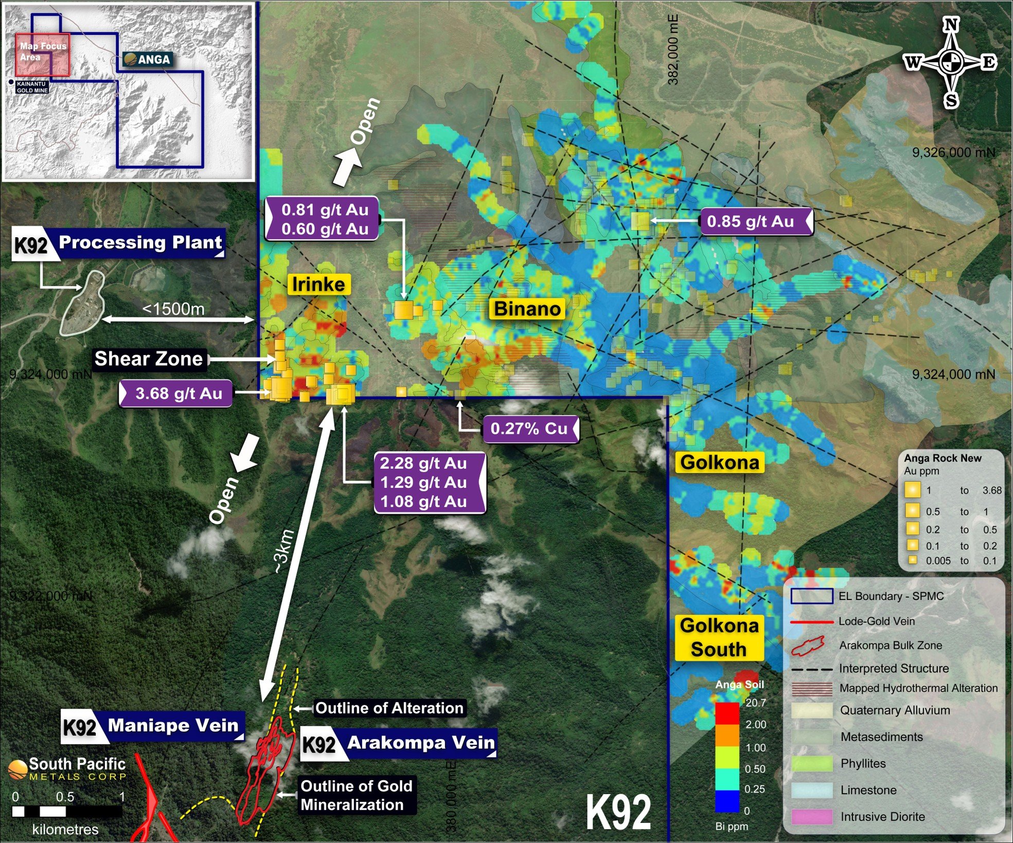
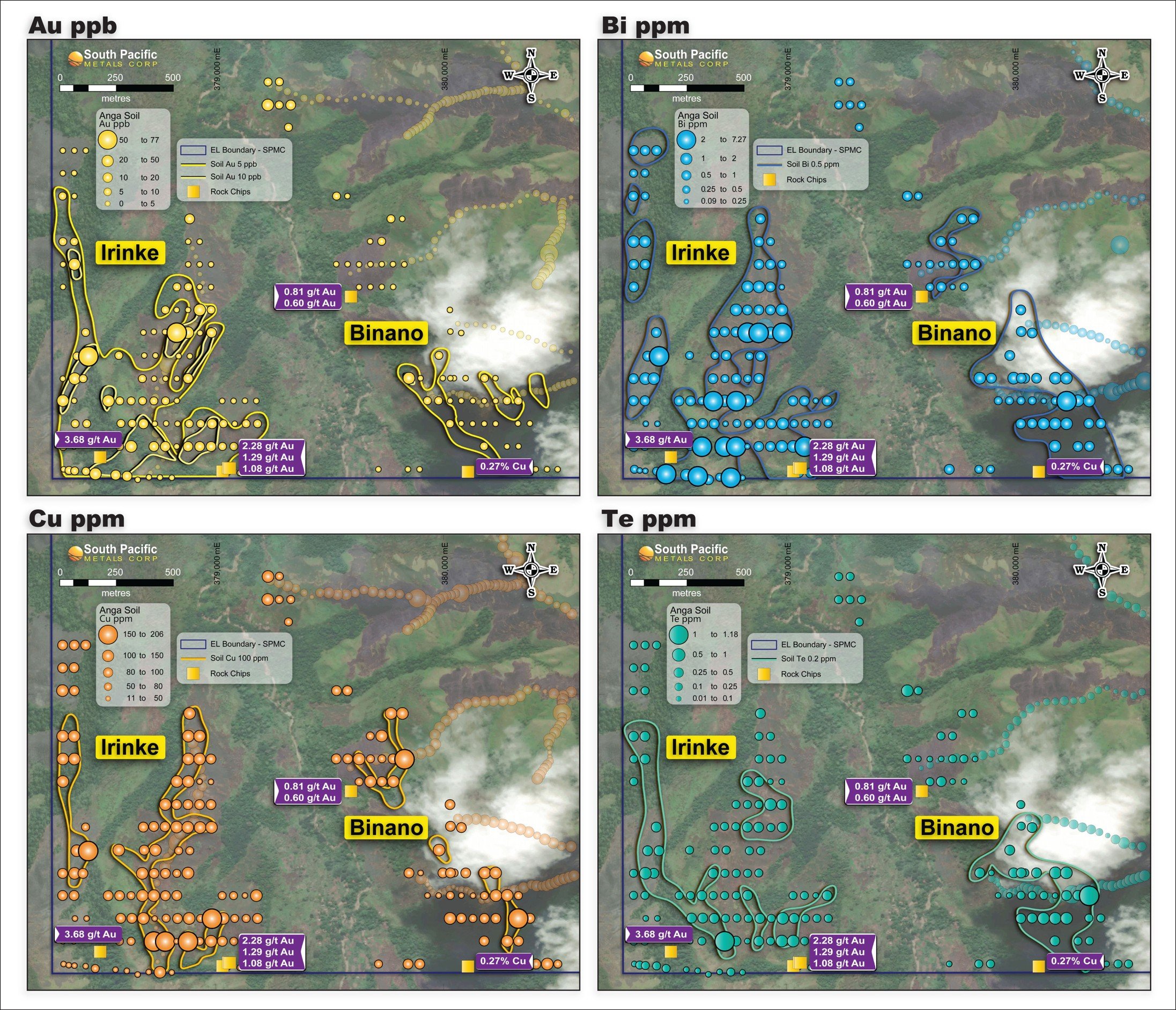
The area is characterised by the presence of the Elandora and Akuna intrusives—igneous rocks associated with copper and gold mineralisation. The project benefits from extensive historical and modern datasets, which are being reinterpreted using modern mineral systems approaches aligned with exploration models relevant to the region.
The Kainantu Transfer Zone (KTZ)
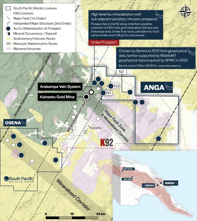
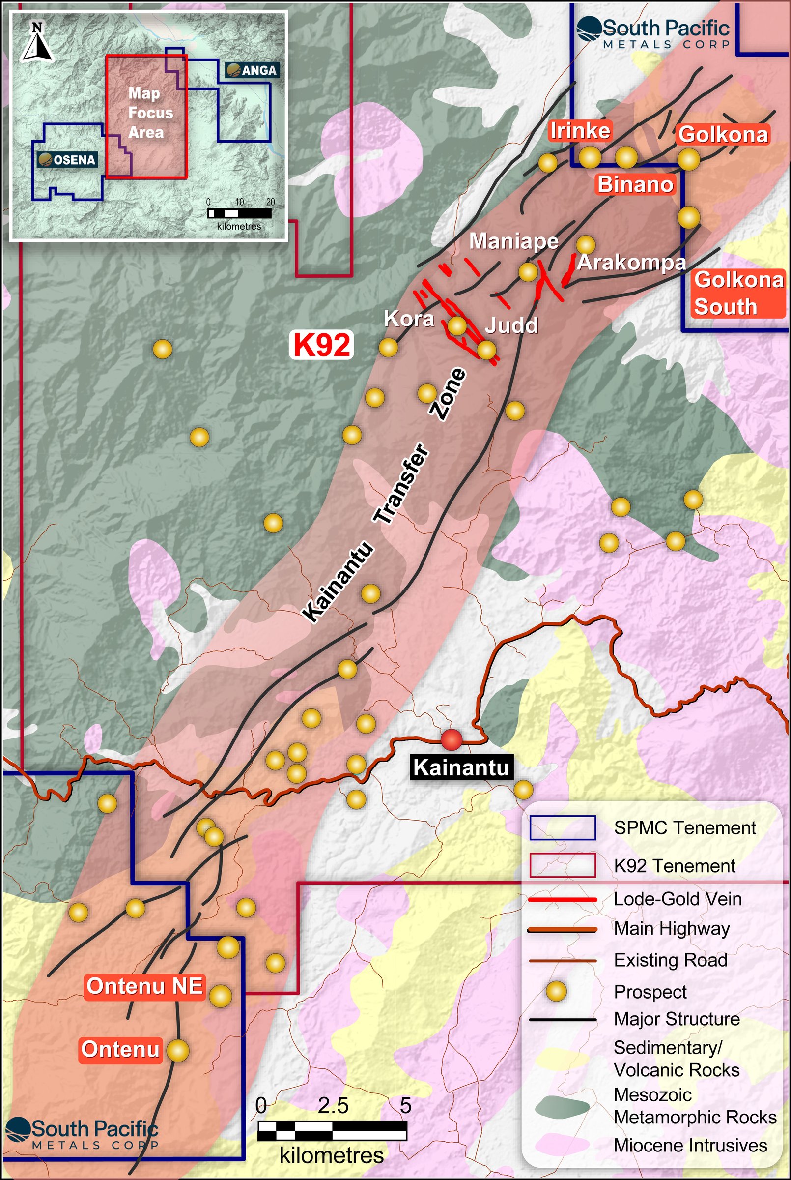
To understand the Anga Project, one must first understand the Kainantu Transfer Zone. This major arc-transverse structural corridor runs through the heart of the Eastern Highlands Province and is one of the most productive gold-copper corridors in the Asia-Pacific region.
The Transfer Zone sits at the intersection of NW-SE arc-parallel first-order strike-slip fault systems and NNE-SSW transfer structures—the exact tectonic geometry that focuses magmatic-hydrothermal fluid flow and produces high-grade gold and copper deposits.
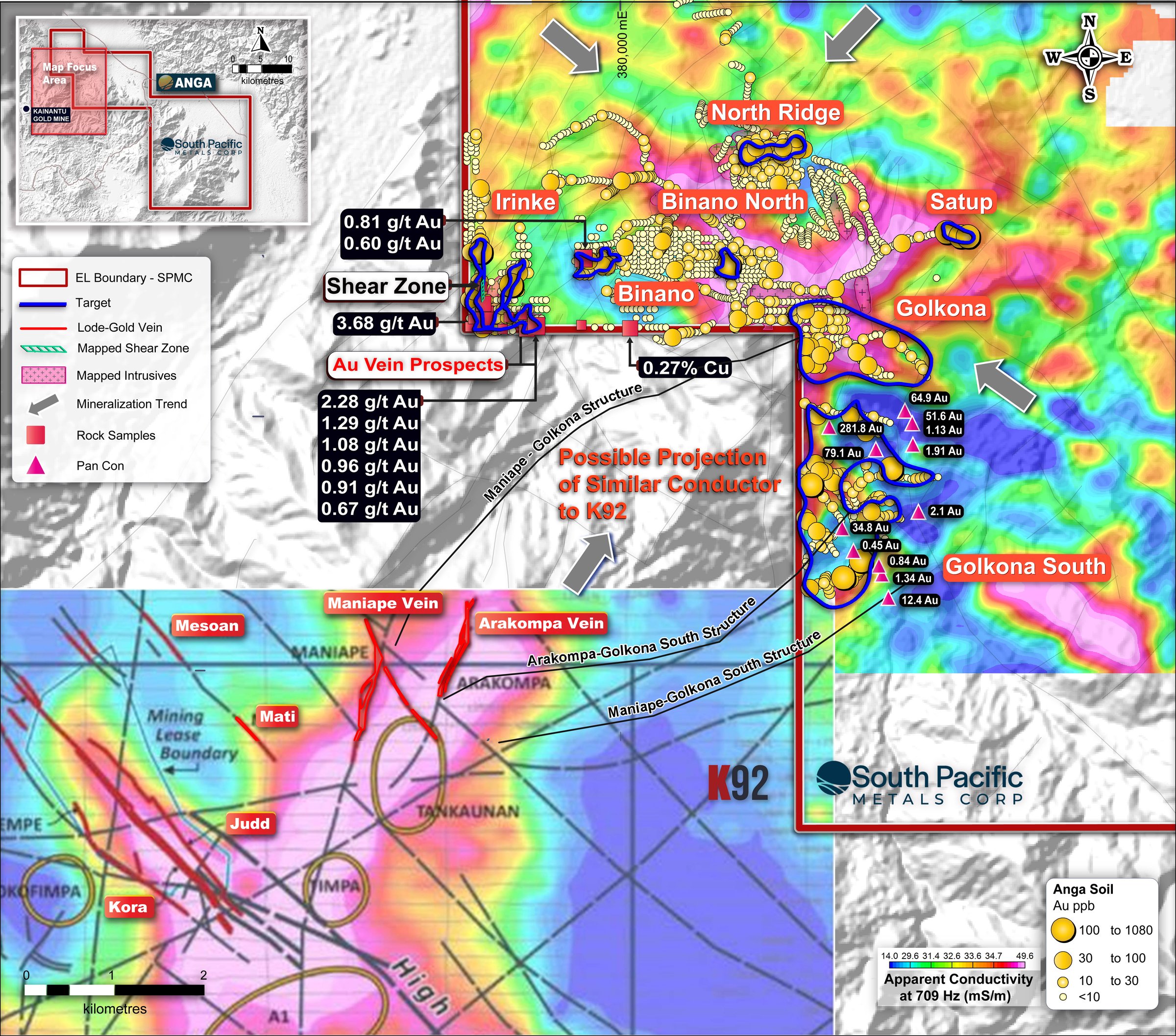
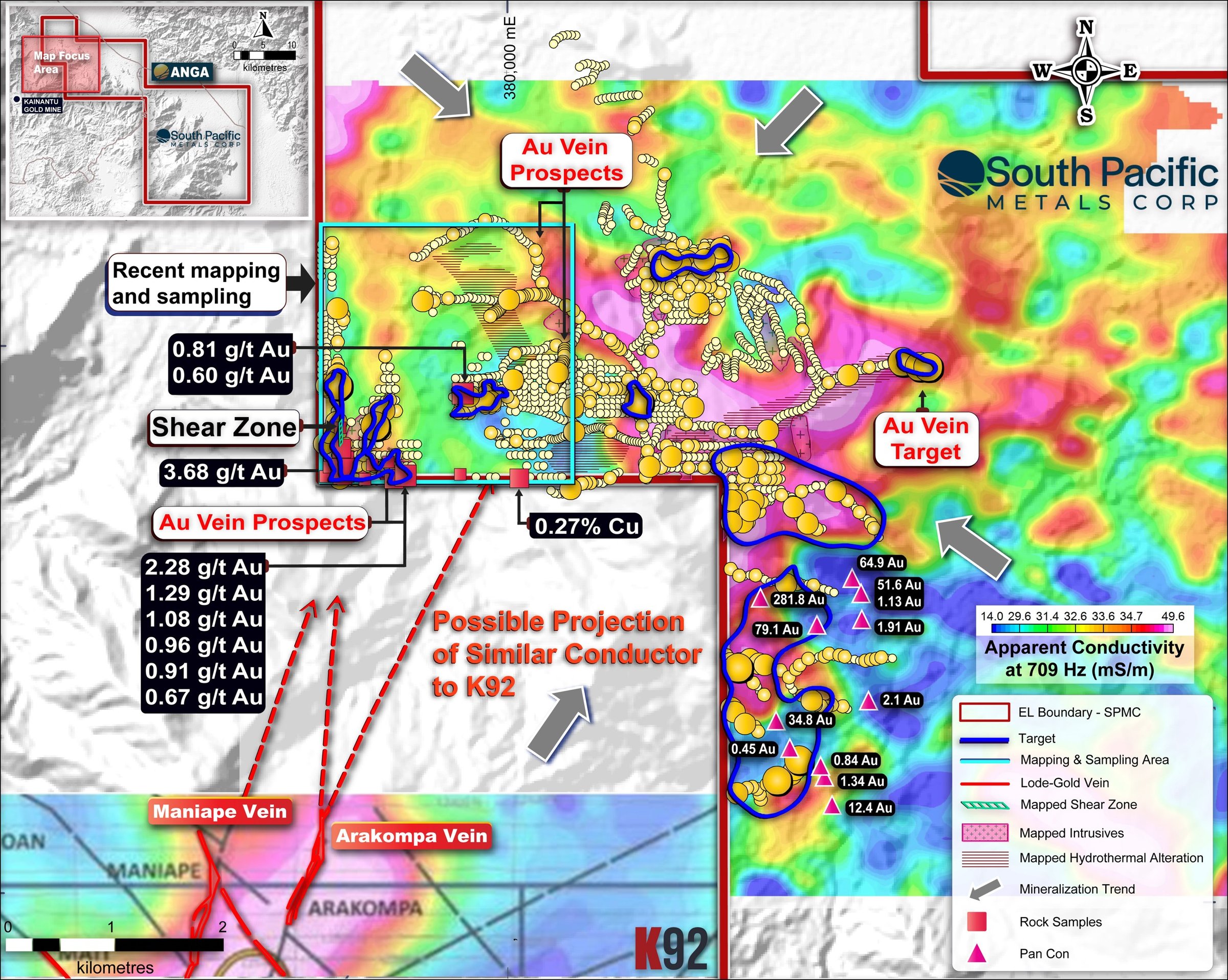
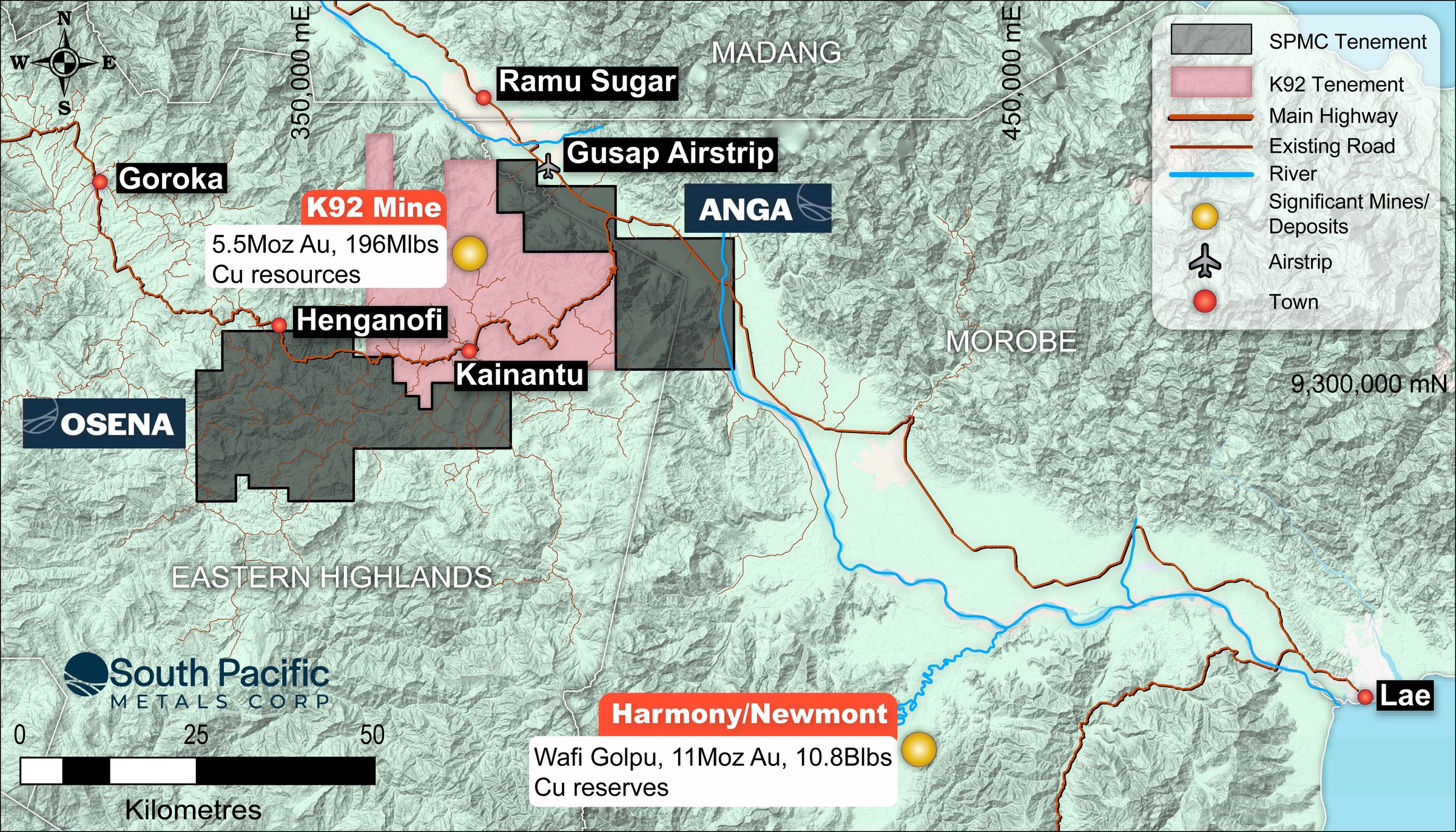
K92 Mining’s Kainantu Gold Mine sits at the heart of this corridor. These high-grade epithermal Au-Cu veins occupy NW-trending dilational structures within the Transfer Zone architecture, the same structural family identified by SPMC within the Anga licence area to the northeast.
The Ramu-Markham Fault Zone, a major terrane-bounding suture trending NW, forms the northeastern boundary of the Kainantu mineralised corridor. SPMC’s Anga Project lies in close proximity to this major structure, within the zone of enhanced permeability and high heat flow that characterises the most productive portions of the Papua New Guinea Thrust Belt (PNGTB). Anga lies within the same arc-parallel, high-fertility structural corridor responsible for multiple world-class deposits across the belt.